Trail Directory Page - Maps & General Info
What Is Covered Here
Please be advised that this site deals only with the Pigeon Creek
NRT system. You may find trails that are not documented here when out on Pigeon Creek
trails. Example: Trail 204 is a Connector trail that leads to an adjoining trail system.
Selecting Trails
For photos, descriptions, and maps for each trail click the trail
number in the trail list below. At the bottom of each trail page you'll see links to
the maps for each specific trail. The easiest way to use the trail system is to print out
the main trail system map. Park at one of the two trail heads, then follow the map to the
trails of your choice.
Trail Maps
There are two types of maps for each trail on this Web site. The
first type is an Outline Map, the second type is a Topo Map (topographical). Any one of
them can be printed out, but your best bet is to print out one of the maps showing the
entire trail system. You will need to use 8.5 x 14 inch paper! The outline maps are much
easier to follow and load faster, but they do not show the detail of the topo maps. Topos
are provided primarily for serious racers who require terrain detail.
Clickable Links Within Maps
In any of the maps you can click a trail numbers and parking lot
symbols (big red "P") for details.
Trail Information -
Click trail number for details on specific trails
Beginner
Level Trails |
Trail
Number |
Length
in Miles |
Trail
Description |
100 |
0.8 |
short and easy, lake
views, starts at east trail head |
201 |
0.5 |
short and easy, tall
pine forest, starts at west trail head |
202 |
0.6 |
old logging road,
popular trail, wide, gentle, starts off #201, |
Intermediate
Level Trails |
101 |
1.7 |
a bit of everything,
technical for bikers, popular with hikers |
102 |
0.7 |
pure mountain bike
bliss! |
103 |
1.0 |
popular with hikers
after a short walk, lots of Ozark flora |
104 |
2.0 |
fast, fun, a true MTB
race course, popular with robust hikers |
105 |
0.8 |
very pretty, but a
tough challenge |
106 |
1.2 |
extreme and mean, right
for those who want to rock and roll! |
203 |
1.5 |
a mile ride downhill, a
great Ozark hike or bike |
204 |
1.5 |
a hillside cling with
great lake views |
Trail
Maps
Please Note!
The Pigeon Creek NRT is constantly
being expanded. We will strive to keep this site current as additions to the system are
documented.
Download
time for maps at 56K is 8 seconds for outlines, 30 seconds for topos |
| Map #1 - trails 201, 202, 203, 204 |
Outline |
Topo |
| Map #2 - trails 100, and 1st half of
101 |
Outline |
Topo |
| Map #3 - 2nd half of 101, 1st half of
102 & 103 |
Outline |
Topo |
| Map #4 - trail 104 |
Outline |
Topo |
| Map #5 - trails 105, 106 |
Outline |
Topo |
| Map #6 - entire trail system ( 60
second download) |
Outline |
Topo |
| Map #7 - printable versions, entire
trail system |
Outline |
Topo |
| Map #8 - location / driving map |
Web page |
Print version |

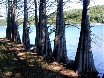
Cypress grove on Lake Norfork near trails
top |

